

Oxwich
Enjoy a walk with a variety of habitats based...
A popular walk enjoyed by locals and visitors on a broad and firm section of the coast path
Paddy Dillon
A walk over Mumbles Hill can be continued inland through the suburbs, linking together a series of green spaces that tend to be visited only by local people. A stretch of the Wales Coast Path can be followed from Caswell Bay and Langland Bay to Limeslade Bay and Bracelet Bay. This stretch of the coast path is broad and firm throughout, much safer than most cliff paths, and is popular with local walkers and visitors.
Distance: 6.8 miles or 10.9 kilometres
Start location: Bracelet Bay, Mumbles
Start Grid Ref: SS 62881 87313
Start What 3 Words: player.spouting.trash
Parking
Parking at Bracelet Bay, Mumbles.
Bus
Daily bus services link Bracelet Bay with Swansea.
Train
None.
The circular route is marked in dark pink in the map image below. The purple flags show the start and finish point. View the route and download GPX link 'Mumbles Hill'

1. There is a large car park at Bracelet Bay with bus stops alongside. Views across the bay take in two islands and one of them is crowned with a lighthouse at Mumbles Head. Leave the car park by using a flight of concrete steps to reach nearby bus stops then follow the pavement alongside the road. Cross the road to follow a track signposted for ‘Mumbles Hill Nature Reserve’. The track curves to the right as it climbs. A short detour to the right leads to the site of a Coastal Defence Battery, otherwise keep left and pass to the left of a Coastguard radio mast, reaching a viewpoint and a noticeboard. Despite being partly obstructed by trees, there is a view across Swansea Bay to the city.
2. Turn left to climb along a woodland path, passing a trig point at 77m, where a sign points ahead for ‘Bunker and Guns’. Another path drops to the right for Mumbles, but keep straight ahead, staying high. The path splits and a left turn leads to Thistleboon Drive, so keep right instead to reach the Second World War bunker and gun emplacements, where plenty of noticeboards offer information. Pass in front of a small mobile home park and continue through a grassy space. A path with 50 concrete steps descends past a few houses to land on the narrow Thistleboon Road. Turn right to follow it steeply downhill then turn left to climb steeply up Tichbourne Street.
3. The final, steepest part of the road leads to a set of gates. Just before reaching them, turn right along a narrow path between fences, passing a sign for Mumbles Ridge Wood. Climb steeply, then the path levels out with woodland dropping to the right and the back gardens of houses to the left, with tall fences or walls alongside. Avoid paths leading to left and right and keep walking straight ahead. A tarmac path leads onto a road which is followed ahead and downhill through a housing estate. Turn left at the first road junction to follow Wychwood Close then turn right to walk gently down Amberley Drive. A fenced tarmac path continues downhill between houses, reaching a very complex road junction. (A short-cut is available down Rotherslade Road, reaching the Wales Coast Path at Rotherslade Bay. Using this would effectively halve the distance of the walk.)
4. Walk straight ahead past Higher Lane and Rotherslade Road and turn left along Langland Bay Road. When this starts descending towards the coast, turn right instead down a narrow road signposted as a public footpath. Follow this until a flight of 70 stone steps can be climbed on the right. The path climbs steeply and continues as a pavement climbing beside Groves Avenue. The road levels out to reach a crossroads. Turn left along Caswell Road, reaching a junction beside St Peter’s Church. Turn left to walk gently downhill along Mary Twill Lane, until public footpath signs point left and right.
5. Turn right, walking gently up and down a short road to reach a junction. Turn right and climb a handful of steps onto a narrow road called Hill Grove. Turn right to walk up it, and it broadens at some houses before narrowing at a junction with Caswell Road. Turn left downhill, following the pavement on the left-hand side of the road. The road drops steeply and the pavement ends, so cross the road and pass a gate to follow a path into woodland as signposted for Bishopston.
6. This is Bishop’s Wood Local Nature Reserve. Always keep to the most well-trodden path ahead, avoiding lesser paths to right and left. Descend on a wooded slope then ascend with more grassy areas alongside and a good view of Caswell Bay. Descend through woods again then climb a little. A longer descent follows the remains of fences through the wood. Buildings are spotted to the right, but keep turning left at path junctions throughout the descent. Have a look at the curious Roundhouse shelter and follow a path gently downhill from it, along the floor of the wooded valley. This leads to a noticeboard explaining about the reserve, beside a large car park. Walk alongside the car park and pass toilets, then cross a road to join the Wales Coast Path at Caswell Bay, where there are snack cabins and a beach cafe.
7. A sandy beach is hemmed in by cliffs and a Wales Coast Path signpost indicates a path behind the snack cabins and cafe, pointing the way to Langland Bay. The path is concrete at first, rising from the bay, then changes to a firm gravel path that mostly has fences alongside. A long, unfenced stretch passes a three-way signpost offering a walk along a cliff-top path, but keep walking straight ahead along the lower path. The path becomes concrete again, with a fence alongside, climbing 14 concrete steps and losing sight of Caswell Bay while turning round a limestone outcrop on Whiteshell Point. The path is seen stretching ahead, rising and falling gently across the rugged slopes, with no sign of habitation. The path is mostly unfenced, then after turning round Snaple Point there is a sudden view of Langland Bay.
8. There is a contrast between the 19th century Scottish Baronial style of Langland Manor, with its tower and turret, and the rows of simple, uniform beach huts. A tarmac path leads round the bay, passing the beach huts. Note how Langland’s Brasserie by the Sea and a toilet block were built in the same style as the beach huts. Pass above the Surfside Café and pass a beach of pebbles, rock and sand. The tarmac path rises past houses then descends to the end of Rotherslade Road, where a cascade of concrete steps serves the tiny pebble and sand beach at Rotherslade Bay, which is hemmed in by little cliffs.
9. Pass in front of a cafe and follow a concrete path uphill. Pass a regular Wales Coast Path signpost, followed by a curious signpost beside an elaborately carved wooden bench. Pass another signpost while walking gently downhill. The concrete path gives way to a tarmac path, which runs up to a three-way signpost offering a route inland to nearby suburbs. However, the Wales Coast Path runs gently downhill, uphill and downhill again, gaining a stout fence alongside. Climb and pass another three-way signpost offering a route inland, but keep walking straight ahead, with no sign of habitation. Climb steeply at times then the tarmac path switches to a concrete path that turns round the rocky outcrop of Rams Tor.
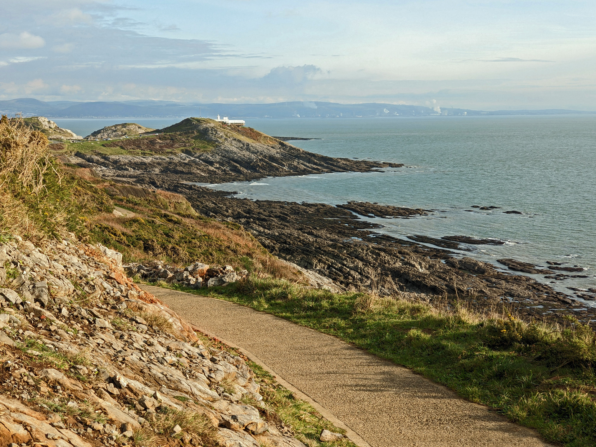
10. The path descends and a lookout station can be seen on the next headland. Look carefully to realise that this stretch of path replaced an earlier path that ran at a lower level. The path joins Mumbles Road, which is followed around Limeslade Bay, passing a cafe and a tiny rock and pebble beach. Follow the road gently uphill to a play park and lots of benches. Either keep straight ahead along the road to finish at a bus stop, or turn right to finish in the car park at Bracelet Bay.

