

Things to do - Carmarthen Bay and Gower
It’s not all walking. In addition to the wide...
Here are a few of our favourites walks and recommendations showing off the best of the Welsh coastline
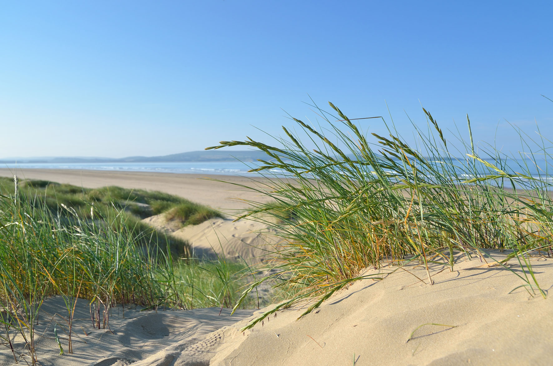
Cefn Sidan Carmarthenshire Phil Fitzsimmons
This section of the path skirts the old red sandstone cliffs and passes below the Anglo-Norman Llansteffan Castle, overlooking the River Tywi. Find out more about the St Anthony’s Well to Llansteffan walk.
This walk offers superb views on each side of Carmarthen Bay and beyond. The path skirts the top of wooded and scrub-covered cliffs. Find out more about the Wharley Point to St Anthony’s Well walk.
The quay is a popular spot for birdwatchers, from where you have excellent views of the town. The adjacent Kymer’s Canal is one of the earliest in Wales. Find out more about the Kidwelly Quay walk (look for "Canal and Quay" walk on the map)
This walk offers superb views across Carmarthen Bay and beyond. The path skirts the top of wooded and scrub-covered cliffs. Carmarthen Bay is an important overwintering ground for seabirds, and for this reason was designated as the first marine Special Protection Area in the UK.
Take time exploring the village of Laugharne before a steep climb up Sir John’s Hill for great views. Along the way you will find Laugharne castle and the world famous Boathouse where the poet Dylan Thomas lived and found inspiration.
The coastline along the northern shore of the Loughor Estuary has been transformed into a unique array of tourist attractions, wildlife habitats and leisure facilities. Known as the Millennium Coastal Park, the route is also bike and wheelchair friendly. Take time to relax in the lovely Pembrey Country Park and visit Cefn Sidan beach. (Train & Bus)
For more information on where to walk the Wales Coast Path in Carmarthenshire, visit the Discover Carmarthenshire website.
An opportunity to explore two of the Gower’s most scenic bays. Find out more about the walk from Langland Bay to Caswell Bay
This is one of the area’s Walking by bus routes. Take the bus to Llanmadoc and enjoy the serene beauty of north Gower. Highlights include Whiteford Burrows National Nature Reserve and the medieval church at Llanmadoc. Excellent for bird and wildlife watchers with views over the Loughor estuary. Find out more about the ‘Walking by bus’ to Llanmadoc walk.
A picturesque walk at the western edge of the Gower Peninsula, chosen by the Ramblers' Association as one of their 'Top 10 Coastal Walking Routes' in the UK.Find out more about the Rhossili to Mewslade Bay walk.
Walk along Swansea Bay’s famous promenade (site of the world’s first passenger railway) with views across the bay to Mumbles Head. Once in Mumbles, reward yourself with an ice cream while you explore the area. If the lifeboat station is open it is worth popping in to find out more about the vital and heroic role the RNLI has played in saving lives at sea here and throughout the country. Find out more about walking Swansea Promenade.
This path will take you through woodland and across open cliffs with the 16th Century Oxwich Castle and 13th Century St Illtyd’s Church as highlights along the way. Find out more about the Oxwich Point walk (look for "Gower Coast walks - Oxwich Point"
This section of the Path crosses pleasant countryside, away from the coast, but it includes magnificent views across three river estuaries and over to the Gower Peninsula. Kidwelly’s main attraction is the imposing medieval castle. (Train & Bus)
The little known gem of the Carmarthenshire coast, with a landscape of spectacular cliffs and beaches reminiscent of neighbouring Pembrokeshire. Pendine Sands has a thrilling history of land speed trials. (Bus)
An estuary-edge walk alongside the Gwendraeth which makes use of the Banc y Lord seawall into Pembrey Forest, a nature reserve managed by the Forestry Commission. Planted on sand dunes, it is mostly a Corsican pine forest, but with deciduous trees growing in parts.
South of Trefenty Farm is an ancient ruined church, where there are medieval graves reputed to be of pilgrims. It is certainly worth visiting these carved gravestones depicting people at rest, but modern research suggest that they are actually of local medieval landowners.
This section follows the Millennium Coastal Park along the edge of Llanelli, a town built on coal working and export, copper smelting and, most famously, tinplate manufacture.
A walk through Pembrey Forest, a nature reserve managed by the Forestry Commission. Planted on sand dunes, it is mostly a Corsican pine forest, but with deciduous trees growing in parts. (Train & Bus)
A relatively easy walk with open stretches of sandy beaches and great views of Three Cliffs Bay, a spot noted for its beauty. There are a few rock scrambles if you wish to take them. (Bus)
In Mumbles, reward yourself with an ice cream while you explore the area. If the lifeboat station is open it is worth popping in to find out more about the vital and heroic role the RNLI has played in saving lives at sea here and throughout the country. Walk to the city along Swansea’s famous promenade (site of the world’s first passenger railway) with views across the bay back to Mumbles Head. (Bus)
An exhilarating walk in one of the most spectacular areas in Wales. The path passes a mix of dramatic cliffs, beautiful beach, undulating upland and wild seascape ensuring exciting views of a wide variety of birdlife throughout the year. Find out more about the RSPB Rhossili Coastal Trail.
A walk along the western end of Gower passing Broughton Bay, Burry Holms island and taking in the length of Rhossili Bay. Tides permitting, there is an option to extend the walk to Worm’s Head. (Bus Sundays only)
To enjoy the best views of the coast, this route takes you along historic sea cliffs which overlook Port Talbot. This walk offers great views of the Bristol Channel with a superb opportunity to view how industry sits within this coastal setting. Explore interesting relics along the way including the ruins of Church of Mary. Find out more about the walk from Margam Abbey to Baglan.
This path follows a stretch of coast rich in wildlife with a spectacular and varied landscape. It passes through National Trust land, much of which is remote, rugged and wild. Port Eynon Bay was voted best British beach in 2011. (Bus). Find out more about the walk from Rhossili to Port Eynon.
The path follows gently undulating landscape, close to sea level for most of the way. There is a steep slope at Bovehill and high tides can sometimes submerge parts of the path. Find out more about the walk from Llanrhidian to Cheriton and back (look for "Gower Coast Walks - Llanrhidian to Cheriton")
